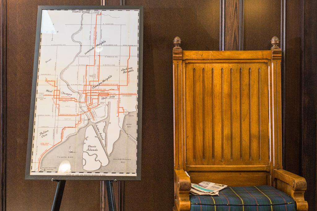
A 2x3.5 foot image rests on an easel in Oxford Exchange. Between The Bookstore and Buddy Brew Coffee Bar, directly next to the shoe shine station is a look back into our city’s past.
It is a hand drawn map of 1940s Tampa. Harbor Island would not exist until decades later and I-275 was not an inbounding route to downtown.
On the map, the Hillsborough River snakes west, then south, drawing natural boundaries throughout the city. Historic neighborhoods that still exist today are beautifully highlighted in hand lettering. Red lines mark the streetcar routes that connect the dots between Sulphur Springs, Ybor City, West Tampa, Hyde Park, and Palma Ceia. Look even closer and you can see faded, yellowed fold marks.
The 1940s map we look at today were results of a city boom decades earlier. The years between 1880 and 1890 were formative years for our city. Tampa exploded from 720 people to over 5,500. During those years, Henry Plant made Tampa the railhead for his South Florida Railroad and Vicente Martinez Ybor and Ignacio Haya opened cigar factories in what is now Ybor City.
Life flourished around the downtown core. Neighborhoods blossomed and industries boomed. This street car service map gives us a glimpse into the past of how residents worked, lived, played, and commuted. The map on display at Oxford Exchange is a look backward.
Maybe we can learn something from this 1940s Tampa streetcar service map. Maybe we need to look backward as we move forward.

Now at the threshold of another resurgence for Tampa, we face important transportation decisions on how to move forward. Forbes labeled Tampa as a top ten fastest growing city and a top ten best city for young entrepreneurs. Fortune ranks us as the hottest city for start-ups. And Realtor.com told us Tampa was the number one city moved to in 2016.
The City of Tampa is exploring a future for the streetcar as a relevant option for residents, workers, and visitors. Our current streetcar system is a 2.7-mile long network connecting Downtown Tampa, Channelside, and Ybor City. It’s mainly used by tourists. The City of Tampa partnered with the Florida Department of Transportation for InVision: Tampa Streetcar Study, considering an extension of the streetcar system through Downtown and potentially north to Tampa Heights.
Expanding the streetcar is not going to single-handedly fix our transportation concerns. But what if it could be part of the solution? What if this investment into our community, businesses, and culture pushes our city in the right direction? When it comes to Tampa’s public transportation, we can do better. Looking back to our streetcar heritage can be part of making that happen.
Millennials ding our city for a lack of public transportation, according to Forbes. More and more middle-aged Americans are preferring public transportation over personal vehicles. Tampa Bay Times journalists reported our region ranks 29 of 30 of the country’s largest metro areas public transit usage and coverage and we spend far less on it than similar sized cities.
I’m looking forward to what expanding our current streetcar means for our city - for our visitors, our residents, and our workers. It could mean people discovering new businesses around town, exploring parts of the city they don’t normally frequent, and ease of navigating our downtown core. I’m looking forward to how this piece fits in the future of success for our downtown transportation, including rideshare options, Downtowner, buses, improved bike lanes, water transportation, and others to come.
Let’s learn from our rich history. The streetcar is more than an heirloom of the past; it’s a rich piece of heritage that just might push us into our future. When it comes to public transportation surrounding the downtown core, we can do better.
Andrea Wolloff

